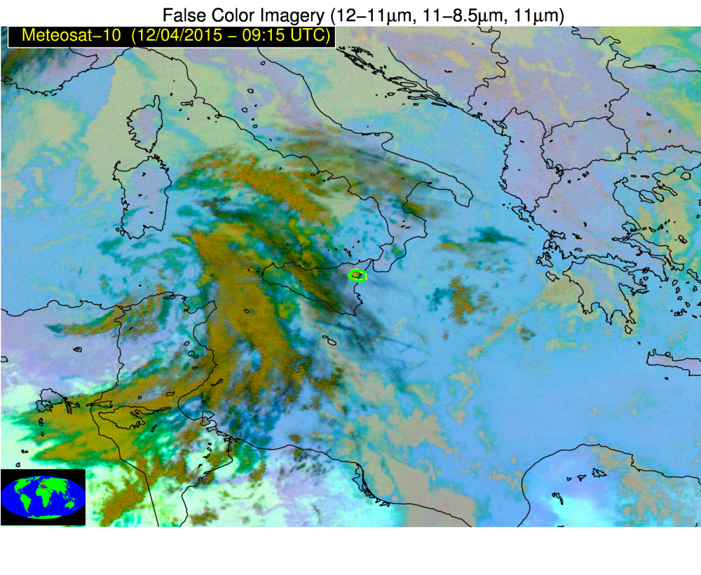
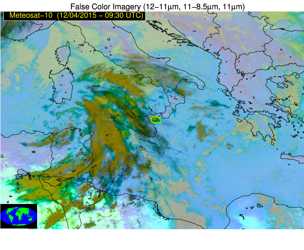
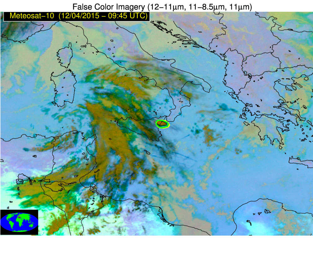
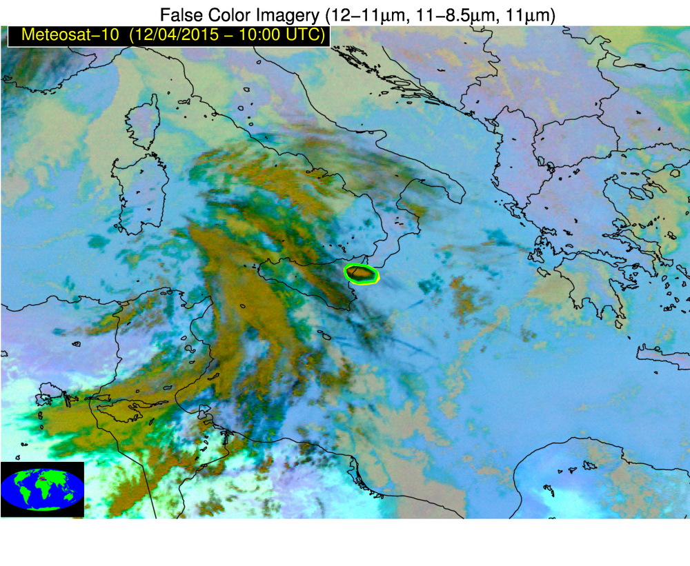
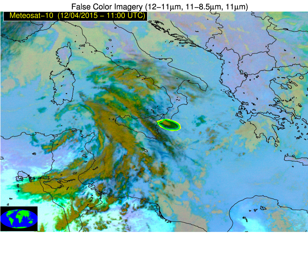
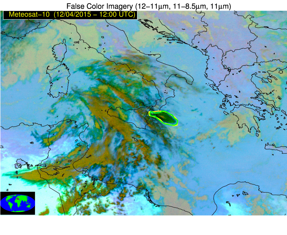
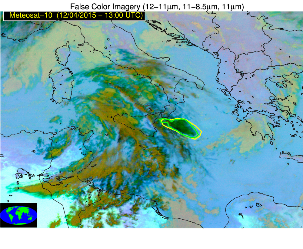
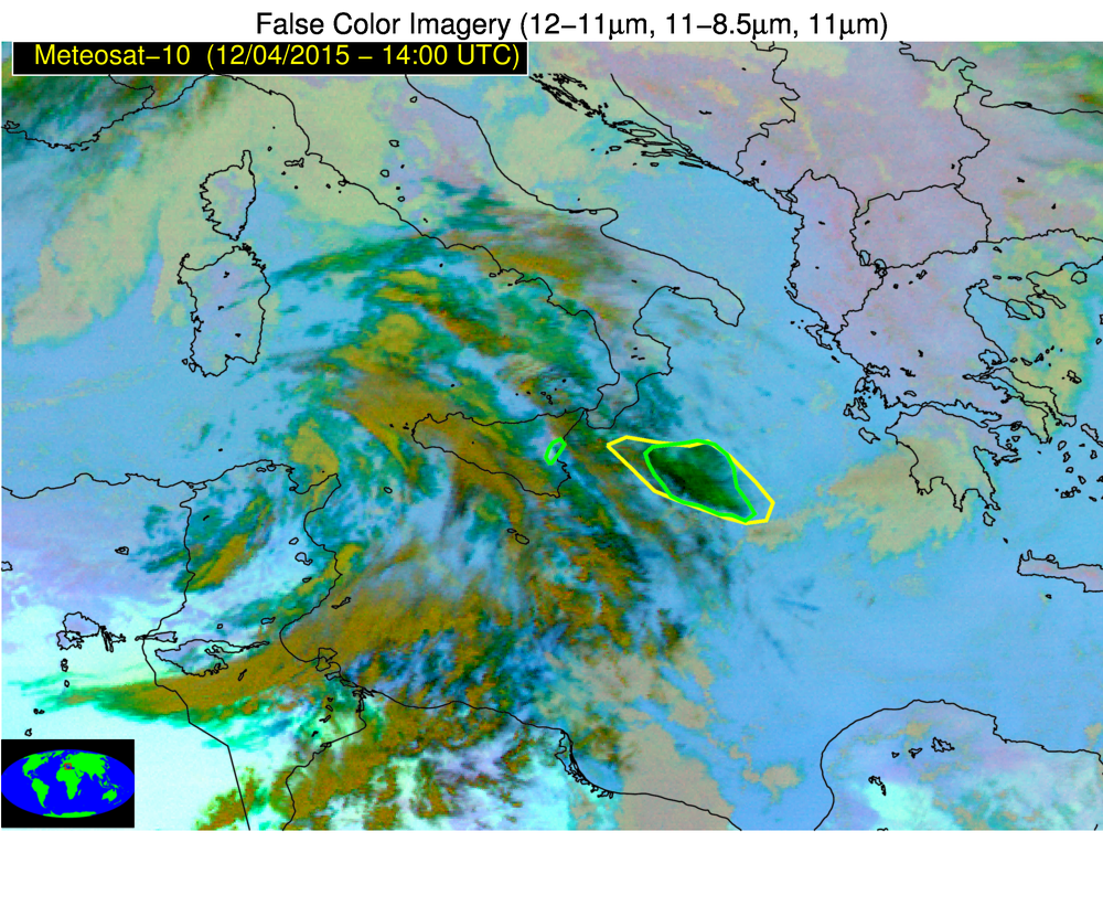
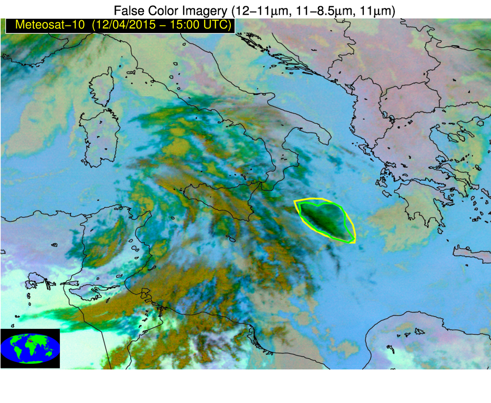
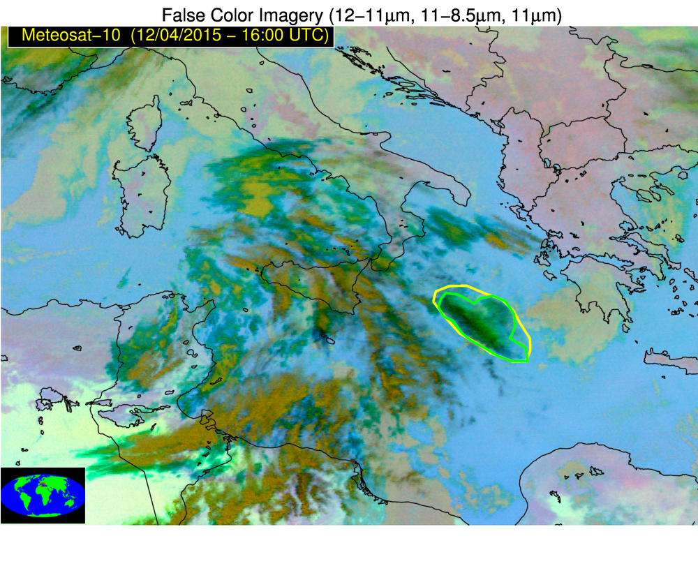
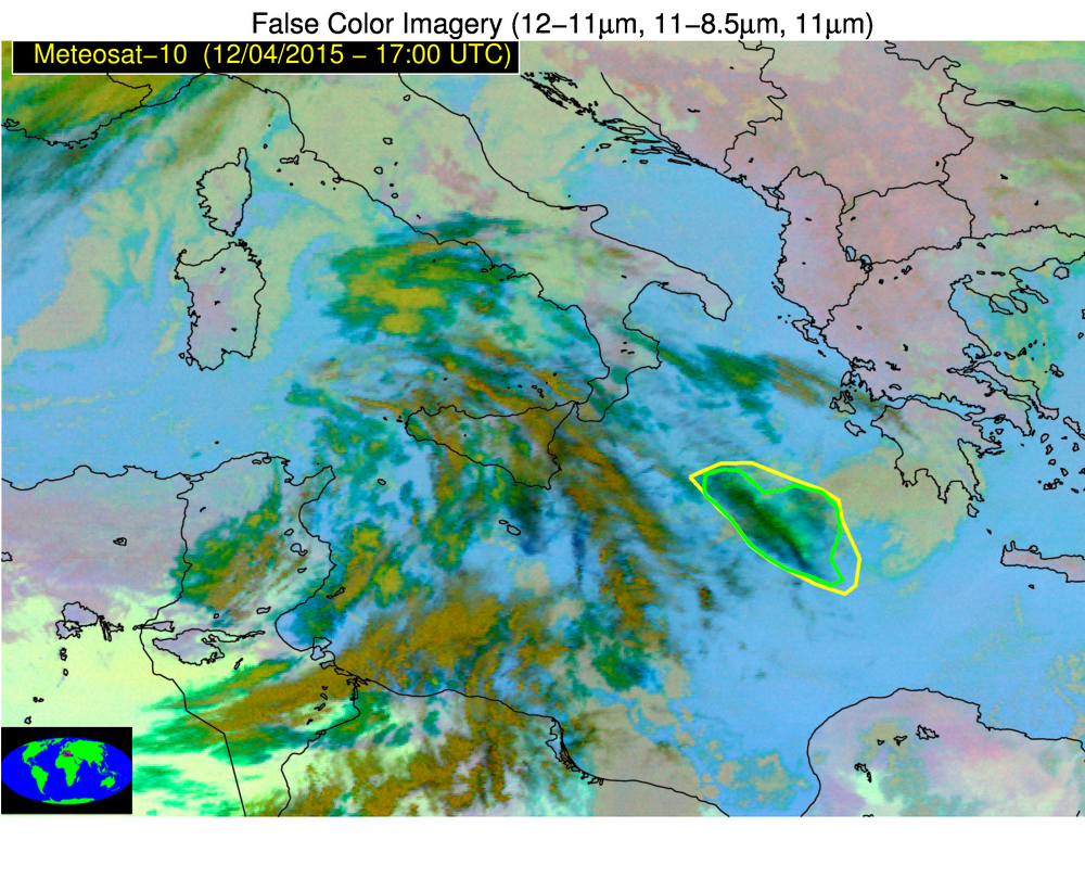
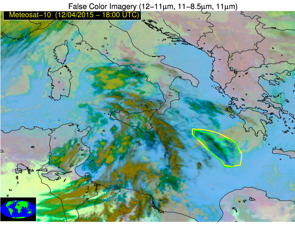
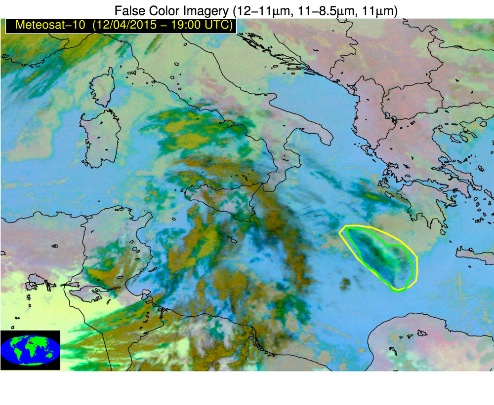
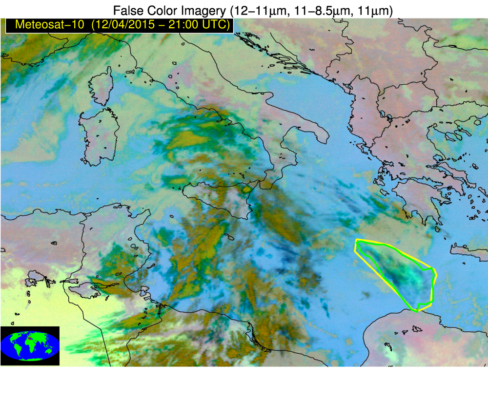
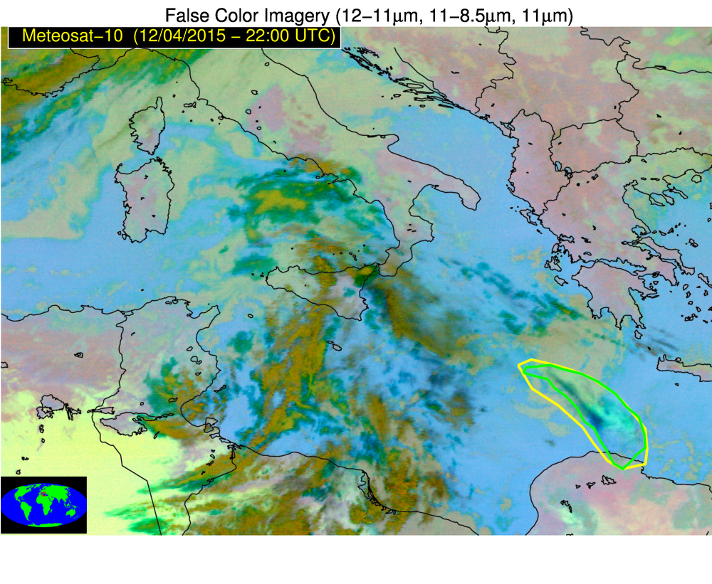
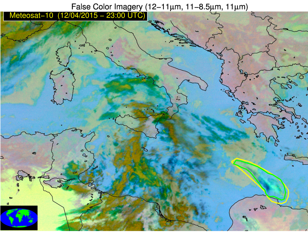
2018 WMO Volcanic Ash Intercomparison — validation for Etna (04 Dec. 2015)
For the 2018 WMO Volcanic Ash Intercomparison, two experts at the University of Wisconsin independently identified volcanic clouds in multispectral infrared satellite imagery. Seventeen times were selected for validation during this eruptive event. The images below show multispectral imagery with yellow and green polygons overlaid, representing the experts’ analysis of where ash is present. Please share your thoughts on the quality of this manual validation analysis by commenting on this post (i.e., is this analysis comparable to where you believe there is and is not volcanic ash?).
For this Etna eruption, ash is not readily discernible from RGB satellite imagery, but the eruptive cloud was identified and tracked by the experts’ manual analysis. As the cloud disperses, an SO2 signal becomes discernible as a light yellow/greenish part of the cloud.
You can see all imagery for this event in this imagery viewer.