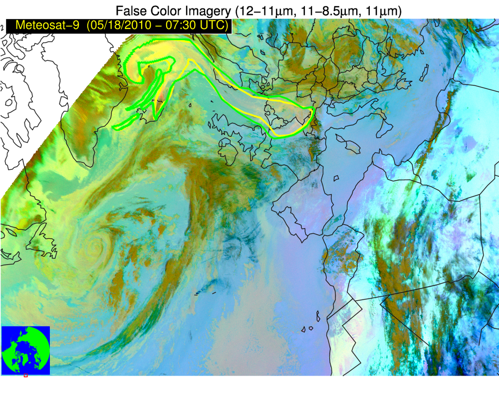
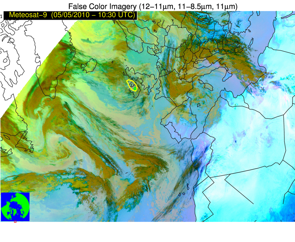
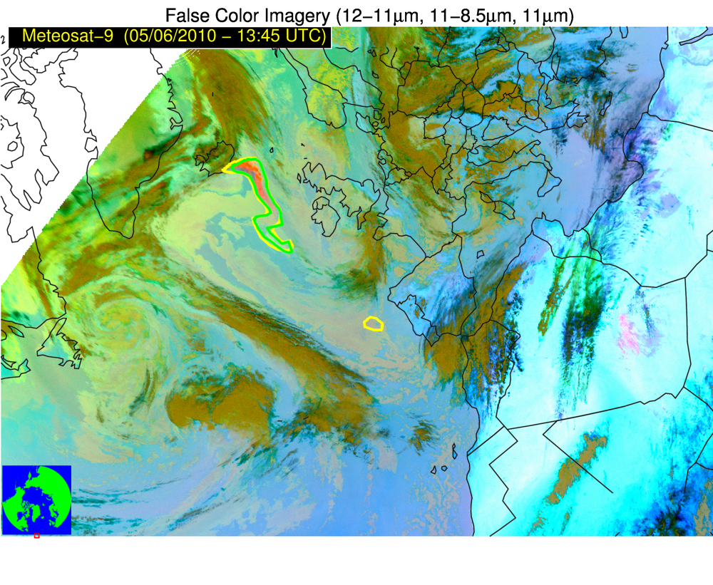
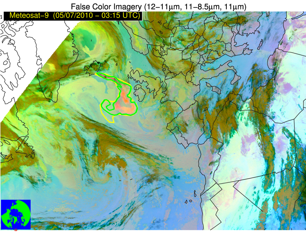
2018 WMO Volcanic Ash Intercomparison — validation for Eyjafjallajökull (05-18 May 2010)
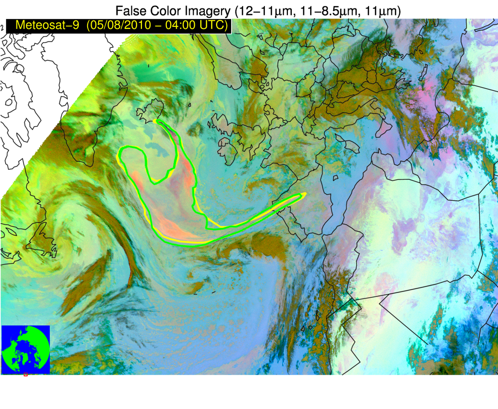
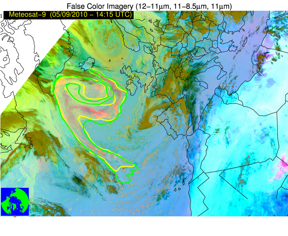
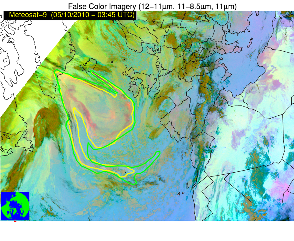
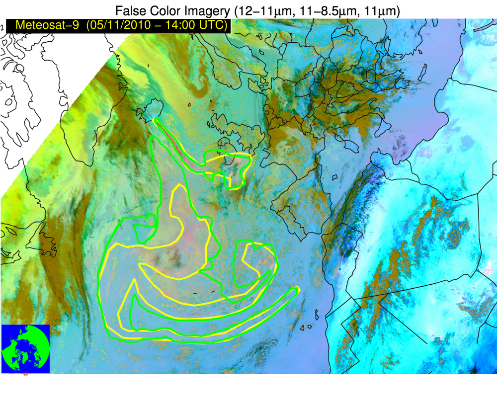
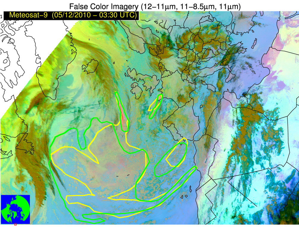
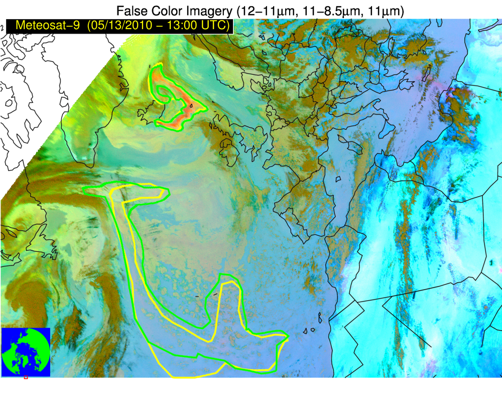
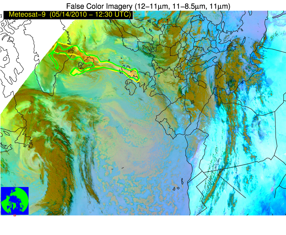
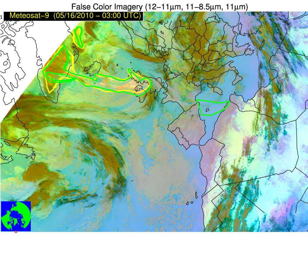
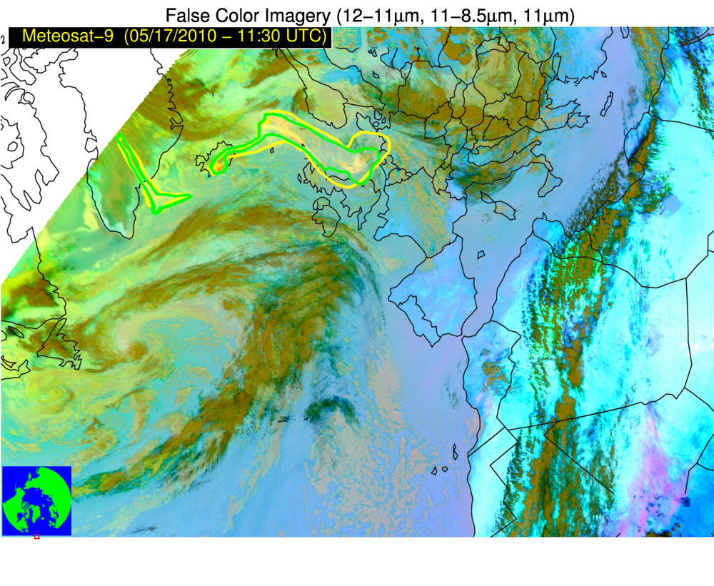
For the 2018 WMO Volcanic Ash Intercomparison, two experts at the University of Wisconsin independently identified volcanic clouds in multispectral infrared satellite imagery. Thirteen times were selected for validation during this eruptive event. The images below show multispectral imagery with yellow and green polygons overlaid, representing the experts’ analysis of where ash is present. Please share your thoughts on the quality of this manual validation analysis by commenting on this post (i.e., is this analysis comparable to where you believe there is and is not volcanic ash?).
Please use the imagery viewer links to animations of the multispectral imagery.
05 May 2010 (imagery viewer)
06 May 2010 (imagery viewer)
07 May 2010 (imagery viewer)
08 May 2010 (imagery viewer)
09 May 2010 (imagery viewer)
10 May 2010 (imagery viewer)
11 May 2010 (imagery viewer)
12 May 2010 (imagery viewer)
13 May 2010 (imagery viewer)
14 May 2010 (imagery viewer)
16 May 2010 (imagery viewer)
17 May 2010 (imagery viewer)
18 May 2010 (imagery viewer)